


Water 2023, 15(17), 3140; https://doi.org/10.3390/w15173140 (registering DOI) - 01 Sep 2023
Abstract
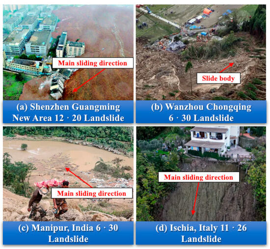
In recent years, mountainous areas in China have faced frequent geological hazards, including landslides, debris flows, and collapses. Effective simulation of these events requires a solver for shallow water equations (SWEs). Traditional numerical methods, such as finite difference and finite volume, face challenges
[...] Read more.
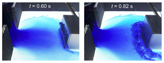
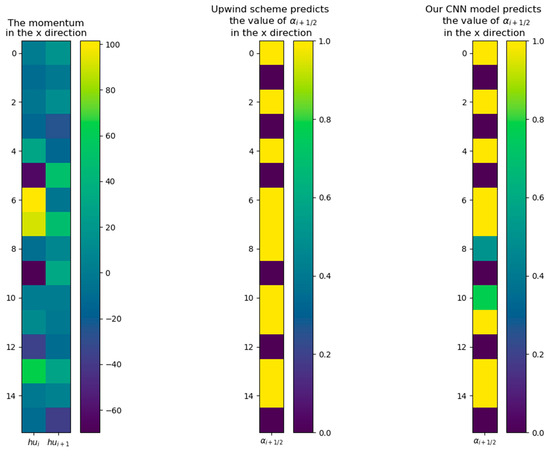
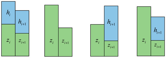
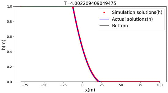
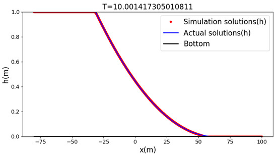
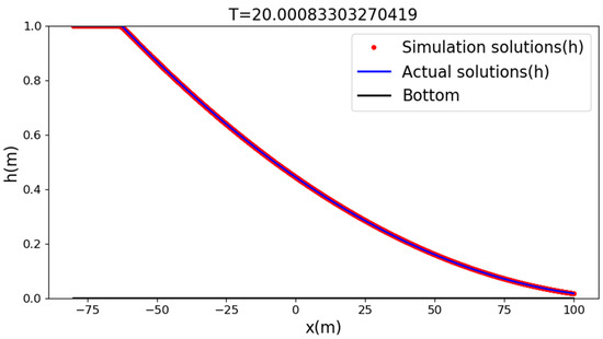
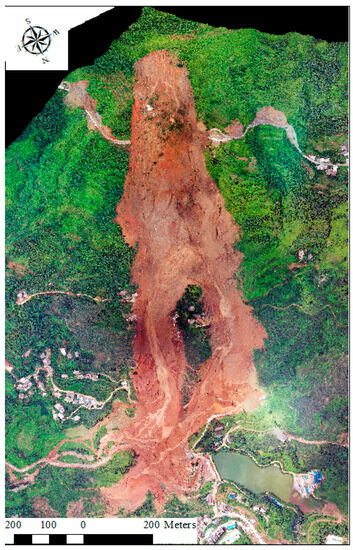
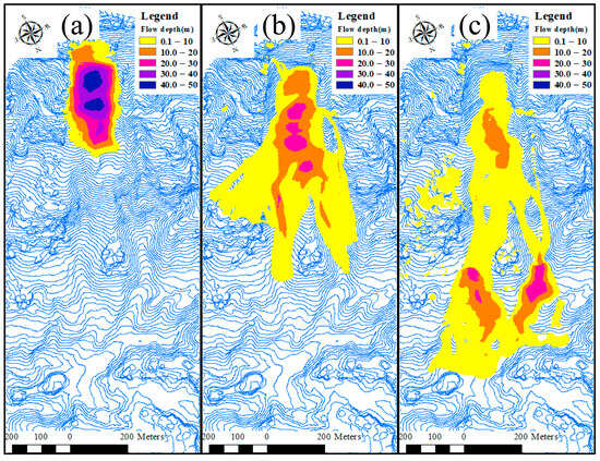
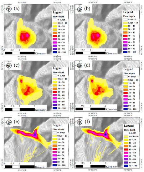
In recent years, mountainous areas in China have faced frequent geological hazards, including landslides, debris flows, and collapses. Effective simulation of these events requires a solver for shallow water equations (SWEs). Traditional numerical methods, such as finite difference and finite volume, face challenges in discretizing convection flux terms, while theory-based models need to account for various factors such as shock wave capturing and wave propagation direction, demanding a high-level understanding of the underlying physics. Previous deep learning (DL)-based SWE solvers primarily focused on constructing direct input–output mappings, leading to weak generalization properties when terrain data or stress constitutive relations change. To overcome these limitations, this study introduces a novel SWE solver that combines theory and data-driven methodologies. The core idea is to use artificial neural networks to compute convection flux terms, and to reduce modeling complexity. Theory-based modeling is used to tackle complex terrain and friction terms for the purpose of ensuring generalization. Our method surpasses challenges faced by previous DL-based solvers in capturing terrain and stress variations. We validated our solver’s capabilities by comparing simulation results with analytical solutions, real-world disaster cases, and the widely used Massflow software-generated simulations. This comprehensive comparison confirms our solver’s ability to accurately simulate hazard scenarios and showcases strong generalization on varying terrain and land surface friction. Our proposed method effectively addresses DL-based solver limitations while simplifying the complexities of theory-driven numerical methods, offering a promising approach for hazard dynamics simulation.
Full article
(This article belongs to the Special Issue Advances in Flood and Drought Disaster Forecasting and Early Warnings through Integrating Hydrological and Hydrodynamic Models)
►
Show Figures
Figure 1


